The Map of the Campus of California Institute of Technology in the 1943-1944 Yearbook
Dublin Core
Title
The Map of the Campus of California Institute of Technology in the 1943-1944 Yearbook
Description
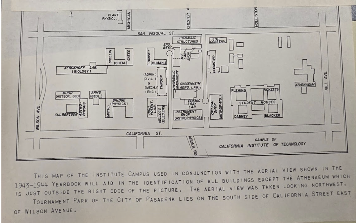
This hand-drawn engineering map, later reprinted in the 1943-1944 yearbook, depicts the Caltech campus during that academic year. Compared with the 1926 campus map, it still focuses on the southern portion of campus, but it includes significantly more buildings with names that remain familiar today, with the buildings not as rectangular symbols, but actual aerial view architecture.
Interestingly, many of the “temporary buildings” mentioned earlier in the 1923 Caltech Catalogue, such as the powerplant, had changed location by the time of the 1943 - 1944 map (Catalogue 44). One interesting detail mentioned in the 1923 catalogue is the department of military engineering. It may have been the precursor to the Guggenheim Aeronautical Laboratory at Caltech (GALCIT), or "Guggenheim Aero Lab” on this map. Established in 1928, GALCIT later received U.S. federal support for rocket science research (“Caltech History”). In 1943, “the Army Air Force asked GALCIT to study the possible use of rockets to propel long-range missiles as well as develop missiles for field use” (“Caltech History”).
Bulletin of the California Institute of Technology Catalogue. Published by the Institute, vol. 32, no. 101, Dec. 1923.
“Caltech History - 14 Facts About Caltech History” Archives & Special Collections, Caltech Library. https://library.caltech.edu/archives/about/caltech-history
“Campus of California Institute of Technology” Caltech. 1943-1944.
Creator
Caltech
Publisher
Caltech
Date
1943-1944
Format
Paper Printed Map
Citation
Caltech, “The Map of the Campus of California Institute of Technology in the 1943-1944 Yearbook,” Electrifying Los Angeles, accessed July 2, 2026, https://www.electrifying.collopy.net/items/show/30.