Colorado River Aqueduct Map
Dublin Core
Title
Description
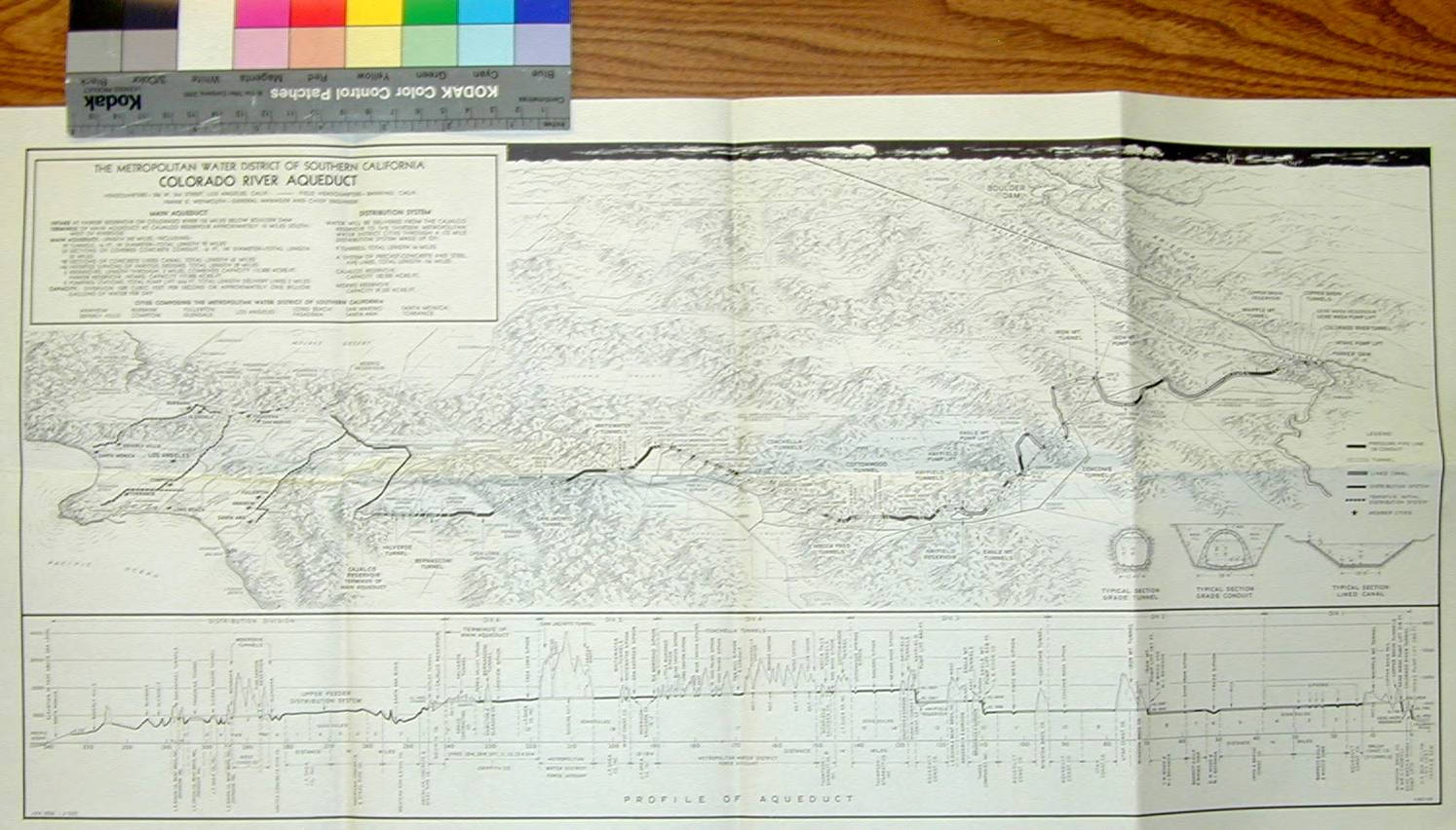
This map of the Colorado River Aqueduct was produced by the Metropolitan Water District of Southern California in April 1936. Stretching nearly 300 miles from the Colorado River to the Los Angeles basin, the aqueduct crossed deserts, valleys, and mountain ranges through an interconnected system of canals, tunnels, reservoirs, and pumping stations.
Engineering profiles recorded key hydraulic conditions along the route, including static head variations of roughly 235 to 320 feet and internal pressures approaching 160 pounds per square inch (Caltech Archives and Special Collections). As such, the aqueduct relied on massive welded steel pipelines nearly fourteen feet in diameter and a series of pumping plants capable of lifting water across large elevation changes. Designing such a system required precise understanding of fluid flow, pressure losses, and pump performance — questions that became a focus of research at the Caltech pump lab.
Kármán's work specifically included comprehensive studies of pumps with different specific speeds and precision acceptance tests of model pumps submitted by contractors for use at locations along the aqueduct route using scaled hydraulic models built and maintained at Caltech (Caltech Archives and Special Collections). This work formed part of a broader program of government-funded collaboration that contributed to major Western water infrastructure projects, including Hoover Dam, Grand Coulee Dam, and the Feather River Project (Von Kármán et al., 1933).
WORKS CITED:
Theodore von Kármán Papers, 10143-MS, Box 107, Folder 5. Caltech Archives and Special Collections. Retrieved March 17, 2026, from https://collections.archives.caltech.edu/repositories/2/archival_objects/46084
Von Kármán, T., Bauman, P., Rowe, R. R., Prandtl, L., Pearce, C. E., Brahtz, J. H. A., Heilbron, C. H., Bakhmeteff, B. A., & Mononobe, N. (1933). Von Kármán on pressures on dams during earthquakes. Transactions of the American Society of Civil Engineers, 98(2), 434–470. https://doi.org/10.1061/TACEAT.0004491